File:Screen Shot 2021-02-03 at 7.33.34 AM.png
From Wooljersey
Size of this preview: 800 × 490 pixels. Other resolution: 2,692 × 1,650 pixels.
Original file (2,692 × 1,650 pixels, file size: 4.3 MB, MIME type: image/png)
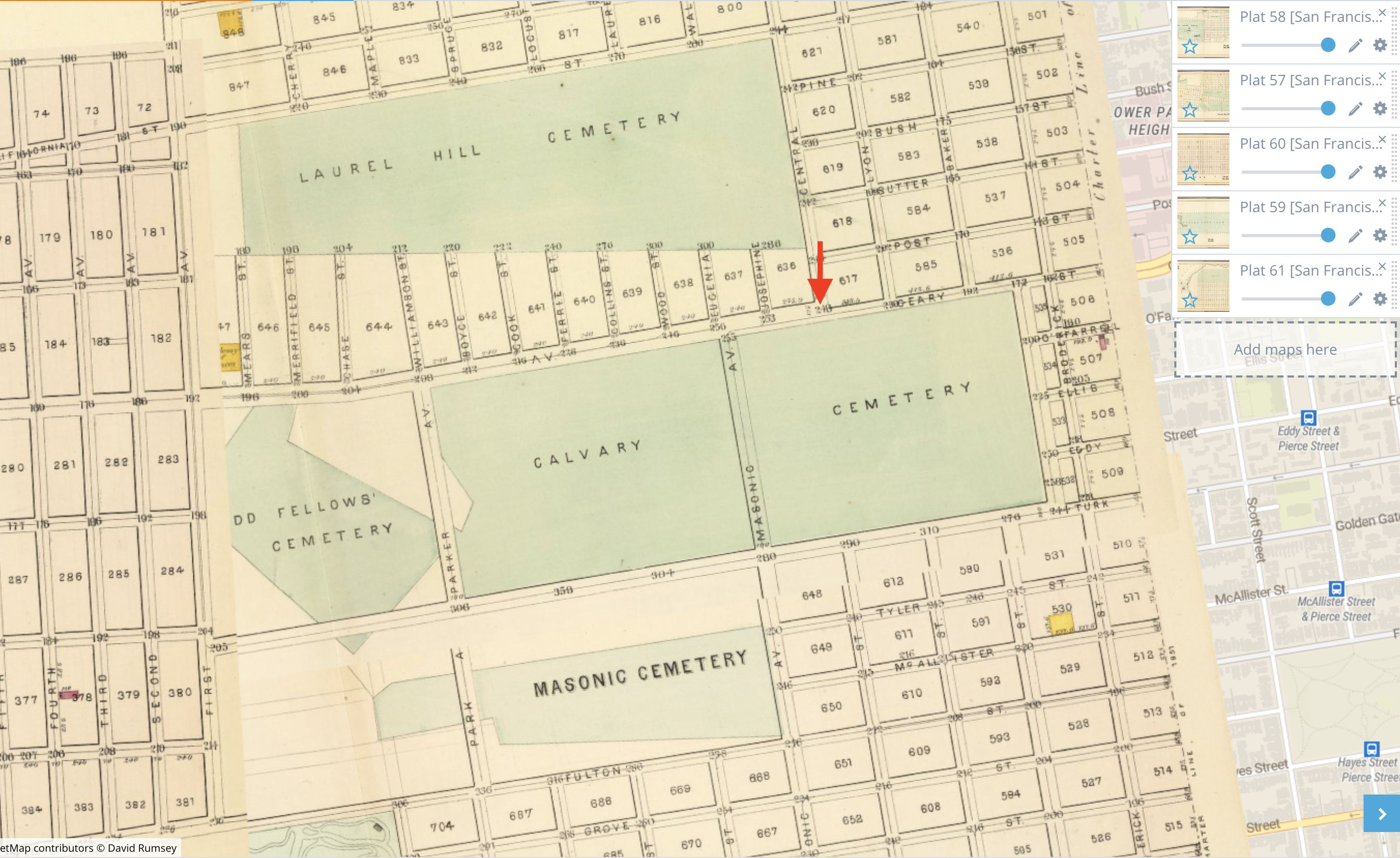
The meeting point at the "old toll-gate" would have been at what is now Geary and Presidio, illustrated by the red arrow in this 1876 map, according to Vestiges of Lands End:
File history
Click on a date/time to view the file as it appeared at that time.
| Date/Time | Thumbnail | Dimensions | User | Comment | |
|---|---|---|---|---|---|
| current | 18:04, 5 September 2021 | | 2,692 × 1,650 (4.3 MB) | Morgan (talk | contribs) | ''The meeting point at the "old toll-gate" would have been at [http://www.georeferencer.com/compare#921121335787 what is now Geary and Presidio], illustrated by the red arrow in this 1876 map, according to [https://www.nps.gov/goga/learn/historyculture/upload/Property_Point_Lobos_Toll_Road_sr_2014.pdf Vestiges of Lands End]:'' |
You cannot overwrite this file.
File usage
The following page uses this file: